Cycling the Grand Western Canal from Tiverton to Holcombe Rogus
In early September, I discovered this rather magical bike ride and now I can’t believe I didn’t know it existed. In a hurry to plan and execute something interesting to do one Sunday morning, I looked on the map and saw there was a canal meadering into the countryside from Tiverton. Huh.
Within 20 minutes we were packing up, ready to go. I did little research and for once, managed not to forget any belongings.
This ride is flat, family friendly, easy to access from numerous places, has excellent parking and, above all, is knock-your-socks-off beautiful.
It can also be walked if you want.

The Prettiest of Devon Bike Rides?
As cycling destinations go, Devon has a lot to show off about. It’s major showstoppers are always hilly though, there simply aren’t many bike rides in Devon than don’t enough distressingly steep country lanes. Okay, it’s not the Highlands, but with Dartmoor swaggering in the middle, it may as well be.
I’m all for hills and mountains, love ’em. But sometimes a good, flat ride is what I’m after. And this is surely the prettiest.
Let’s get started.
Because I didn’t have time to do any research before hopping in the car to get to the start, in my head, parking in Tiverton would be a nightmare (I’m not very familiar with the town). So, instead of thinking this through, I decided we’d park in the car park just to the west of Halberton.
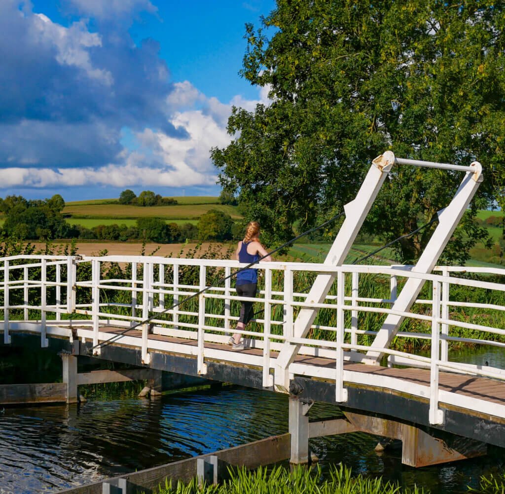
The car park is free, gravel and has room for perhaps twenty cars. There was a little horse box cafe there too, which only serves to make this particularly pretty car park even more amenable. We set off almost immediately, wheeling over the lifting bridge (above) and turning right.
Now, before we go any further, let me say this. I’d intended on scrapping Tiverton altogether and cycling from here along the canal to its navigable termination, at Holcombe Rogus. However, I’d gotten a little disorientated and turning right at this car park actually lead to Tiverton. Yes, there was a signpost, no, I did not read it.
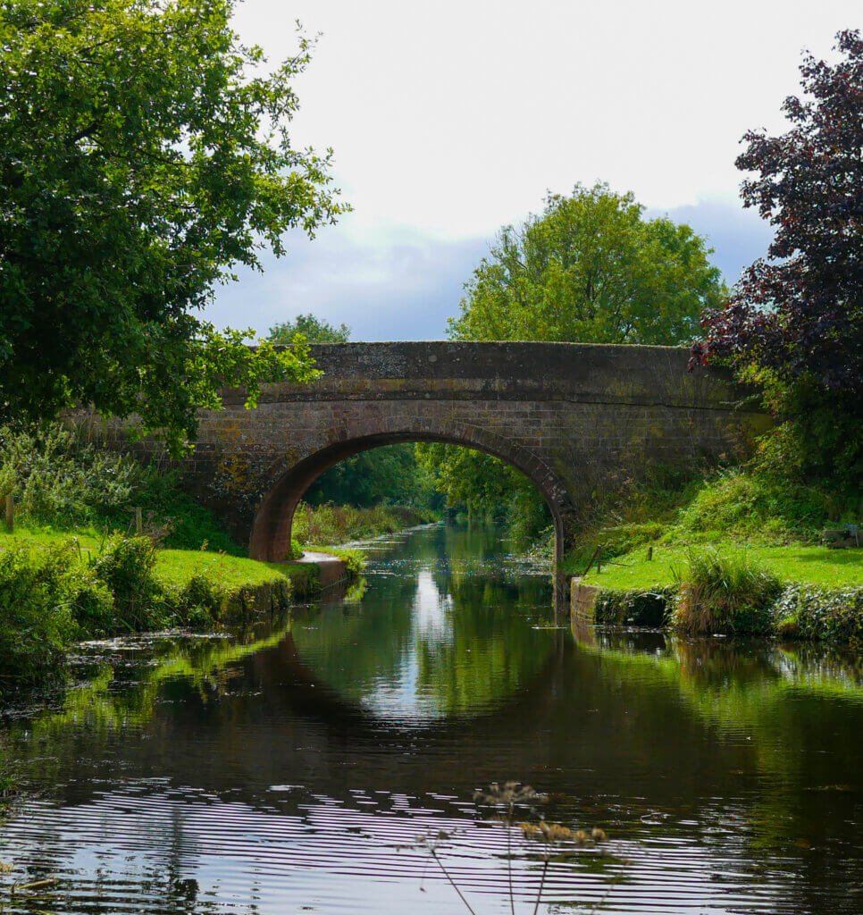
So me and my ever-trusting partner turned right and I have no regrets because this is the first thing you see:

The Background of the Grand Western Canal
Originally conceived as a canal to link the English Channel with the Bristol Channel (from Exeter to Bristol) to bypass Cornwall’s lengthy peninsula, its main purpose ended up being the transportation of limestone and coal. After many delays, construction work begin in 1810 – in the middle of the proposed route. Because of the limestone quarries at Tiverton, creating a navigable canal here would allow it to be used before the entirety was completed.
A good decision really, given that it never was completed.
Lime kilns were constructed after the canal began leaking, the remains of which are still clear. Construction paused, continued and finally ended. Now, the Tiverton to Holcombe Rogus section is all that remains as a navigable canal, carefully maintained by the council and protected as a nature reserve.
Peddling Around Tiverton
Riding along from Halberton to Tiverton was absolutely stunning. The canal was flat and remarkably clear. The late summer haze danced across the surface as ducks flowed along in feathery formations. The path was smooth and, luxuriously, without any sense of incline.
We streamed our way to Tiverton, even though I hadn’t realised it yet. After two miles or so, the banks were getting more built up, houses with gardens running down to the edge. Every five minutes we passes under another historic bridge, vines taking over the brickwork.
I only realised we’d gone the wrong way when we arrived in Tiverton proper, where the canal abruptly ended and the large car park, complete with public toilets and a cafe, sat below.
‘Ah.’
No matter, at least this way we would get to cycle the entire canal. We took the opportunity to relieve ourselves and peddled back towards the car.
Waving to the car on the way past, we were finally cycling in the direction of Holcombe Rogus.
A day of immense sunshine, the path was surprisingly quiet. We’d only see people when there was a car park close by and most were walking their dogs. The air was full of the sounds of rural England and it felt as though we were miles from any settlements whatsoever, fields peeling off each side of the canal.
Occasionally we’d come across narrowboats, moored and silent, their paint lovingly cared for and bright in the sunshine. The bull rushes stood out like a painting, too perfect, too storybook. This was kingfisher territory.
The trail is a little over 11 miles (18 km) long, in each direction but you wouldn’t know it. It’s so easy to just keep peddling with almost no effort at all. This is truly a trail for bridge-lovers too – there are innumerable. When you go under each one, there’s a sign advising you walk your bike because it’s a blind corner. Plus, should you lose your balance, you’d end up in the canal.

We eventually arrived at the termination of the restored canal. It’s final, with a fence end the end and a drop behind where you can make out its continuation – albeit it a plant-clogged one. A far cry for the romantic, postcard canal we’d just cycled along. It finished close to Holcombe Rogus and you’ll find a picnic bench there, on which to marvel at the water boatmen skimming on the otherwise still surface (If you’re walking, you can actually continue along the disused section as a footpath goes onward).
It’s almost absurdly English.
Thankfully, no one’s thought to commercialise the canal particularly. Which is interesting, given that canal are inherently commercial constructions.
Anywhere else I can imagine pub gardens spilling out onto the path, cream tea cafes and ice cream vans. But here, on the Grand Western Canal, it almost feels like a secret.
The Route
Distance: 23 miles (37 km)
Time: 2.5 hours including a good Thermos stop and a couple of brief pauses
Car Parks: Tiverton Canal Basin (charge), Halberton and numerous spots to park along the canal.
Toilets: Tiverton Canal Basin and the recreation ground in Sampford Peverell, off the route
More Info: Devon County Council page
Map: See below